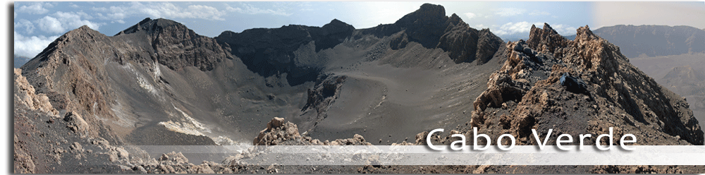
The geographic scope of the project is limited to the geographic area of the archipelagos of the Azores, Madeira and the Canary Islands, in the Atlantic Ocean.

The Autonomous Region of the Azoresis composed of nine islands that vary greatly in size (from the 17 km2 of Corvo to the 747 km2 of San Miguel), with a total surface area of 2,352 km2. The geological ages of the islands vary from the 8.12 million years of the island of Santa María, the oldest, to the 37,000 years of Pico, the youngest. Their physical characteristics are fairly homogeneous, although, due to their volcanic origin and geographic dispersion, there are certain differences between them. In fact, maximum altitude between islands varies noticeably, from the 402 m of the island of Graciosa to the 2,351 m of the peak of the mountain on the island of Pico, the highest point in Portugal. Most of the islands have a maximum altitude of around 1,000 m, and a significant part of their territory is to be found between 100 and 400 m. The islands of Santa María, Graciosa and Terceira have development areas close to the coast at relatively low altitudes (300 m). The archipelago is rounded off with the islands of Flores, Faial and San Jorge.
The population of the Region amounts to 243,018 inhabitants, distributed between the nine islands. San Miguel has the largest population with some 132,671 inhabitants, followed by Terceira with 55,697. Corvo is the least populated, with a mere 468 inhabitants. (Portuguese National Statistics Bureau, 2007).
The Archipelago of Madeira, with a total surface area of 797 km2, is made up of the islands of Madeira, the largest and most important island, with a surface area of 737 km2, Porto Santo, with 42 km2 and two groups of uninhabited islands: Desertas, with approximately 14 km2 of total surface area, and the Salvagem (Salvagem Grande and Salvagem Pequena), the smallest and most remote islands of the archipelago, with a total surface area of approximately 4 km2.
The Autonomous Region of Madeira has a population of 245,806 inhabitants (Portuguese National Statistics Bureau, 2007) distributed between the two larger islands, Madeira with some 240,000 inhabitants, and Porto Santo with 5,000 inhabitants. These islands have very different characteristics from the geological, morphological and climate point of view.
The main economic activity of the region is tourism, receiving visitors all year round in search of its mild climate, mainly from Europe.
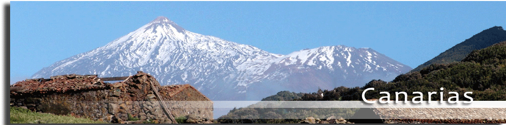
The Canary Island Archipelago is made up of 7 main islands and 6 small islands and islets. The total surface area of the archipelago is 7,492 km2, with La Graciosa as the smallest inhabited island (29 km2) and Tenerife the largest (2,034 km2), followed by Fuerteventura (1,655 km2) and Gran Canaria (1,560 km2). Only two of the islands (Tenerife and La Palma) rise to over 2,000 metres in altitude, with the highest peak being Mt. Teide, at 3,718 m, making it the highest mountain in Spain.
The Canary Islands presently have a population of some 2,025,951 inhabitants (Canary Island Statistics Bureau, 2007). The most populated islands are Tenerife (865,070 inhabitants), Gran Canaria (815,379 inhabitants) and Lanzarote (132,366 inhabitants). The least populated island is El Hierro with 10,558 inhabitants.
The economy is based on the tertiary sector (74%), mainly tourism, which has driven the development of the construction sector. There is little industry, basically agro-food industry. The construction sector is the one that has contributed most growth over the last decade, but it currently faces a downturn.